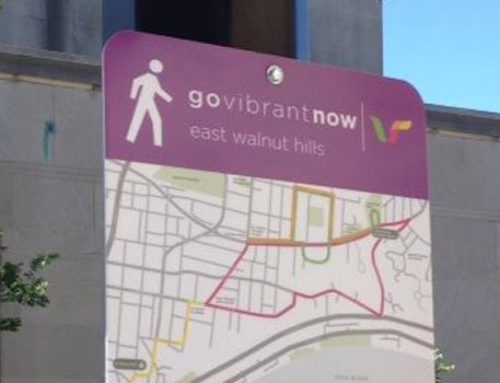
You’re seen the signs up around downtown, Mt Adams, Northside, Avondale and East Walnut Hills – the ones with the little dude walking and pointing out a 1, 2, or 3 mile route. Well those same signs will be coming soon to three other neighborhoods: Walnut Hills, Madisonville & Golf Manor.
Walnut Hills maps are already available on our website to download so you can take a self-guided tour through neighborhoods and see such highlights as the Walnut Hills Cemetery (one of the city’s oldest and home of the annual Cystic Fibrosis Run Like Hell), former home of Harriet Beecher Stowe, author of Uncle Tom’s Cabin, and the gothic Walnut Hills Presbyterian Church Tower. Yes the signs will be up soon, but there’s no reason to hesitate – download the map today and discover one of Cincinnati’s oldest neighborhoods!
Look for Madisonville launching on July 28, and Golf Manor routes later this fall. More neighborhoods are also in the works. Like us on Facebook (www.facebook.com/govibrant) – that’s the easiest way to stay in touch with what’s new.
In the meantime, grab friends and family and take a 20, 40, or 60 minute walk through any of the neighborhoods that already have maps. Walking time is an average pace, unless of course you stop to sightsee, grab a coffee or some other great distraction.
going Vibrant has never been easier! #govibrantnow


Leave A Comment